E-SMLC Location Services Guide
OmniLCS implements an Evolved Serving Mobile Location Centre (E-SMLC) that provides UE positioning for LTE networks. The E-SMLC determines UE location using multiple positioning methods and communicates with the MME via the SLs interface using native LCS-AP over SCTP per 3GPP TS 29.171.
Architecture
Positioning Methods
Cell ID
The simplest positioning method. Returns the geographic position of the serving cell from the cell database.
- Accuracy: Cell radius (typically 100m - 5km depending on cell type)
- Latency: Milliseconds (local database lookup)
- UE Support Required: No
- eNB Support Required: No
The engine first attempts to look up the serving cell in the local cell database. If not found, it sends an LPPA E-CID Measurement Initiation Request (with cell_id quantity only) to the eNB via the MME using LCS-AP Connection Oriented Information to obtain the cell identity.
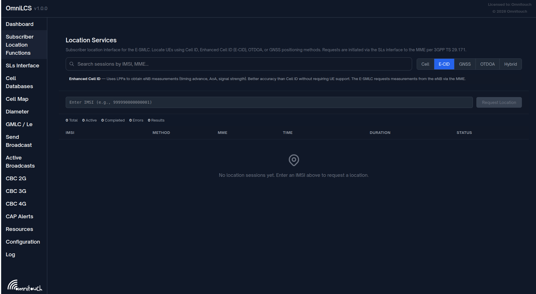
Enhanced Cell ID (E-CID)
Uses LPPA to obtain radio measurements from the eNB, including timing advance and signal strength.
- Accuracy: 50m - 500m
- Latency: 1-5 seconds
- UE Support Required: No
- eNB Support Required: Yes (LPPA)
Measurement quantities requested:
| Quantity | Description |
|---|---|
| Cell ID | Serving cell identity |
| Timing Advance Type 2 | UE-to-eNB propagation delay (distance estimate) |
| RSRP | Reference Signal Received Power |
| RSRQ | Reference Signal Received Quality |
GNSS / A-GPS
Requests the UE to report its GPS coordinates via the LPP protocol.
- Accuracy: 5m - 50m
- Latency: 5-30 seconds
- UE Support Required: Yes (GNSS capability)
- eNB Support Required: No
The E-SMLC sends an LPP Request Location Information message for GNSS to the UE through the MME via LCS-AP. The UE performs a GNSS fix and reports its coordinates back via LPP, relayed through the MME in a Connection Oriented Information message.
OTDOA
Observed Time Difference of Arrival. Uses multilateration from Positioning Reference Signal (PRS) measurements across multiple cells.
- Accuracy: 10m - 100m
- Latency: 5-15 seconds
- UE Support Required: Yes (OTDOA capability)
- eNB Support Required: Yes (PRS configured, LPPA)
OTDOA steps:
- Request OTDOA cell information from eNB via LPPA (relayed through LCS-AP Connection Oriented Information)
- Receive PRS configuration, cell IDs, EARFCNs for reference and neighbour cells
- Send PRS assistance data to UE via LPP (relayed through LCS-AP Connection Oriented Information)
- Request RSTD measurements from UE via LPP
- Receive RSTD measurements
- Run multilateration to compute position
SLs Interface -- LCS-AP over SCTP
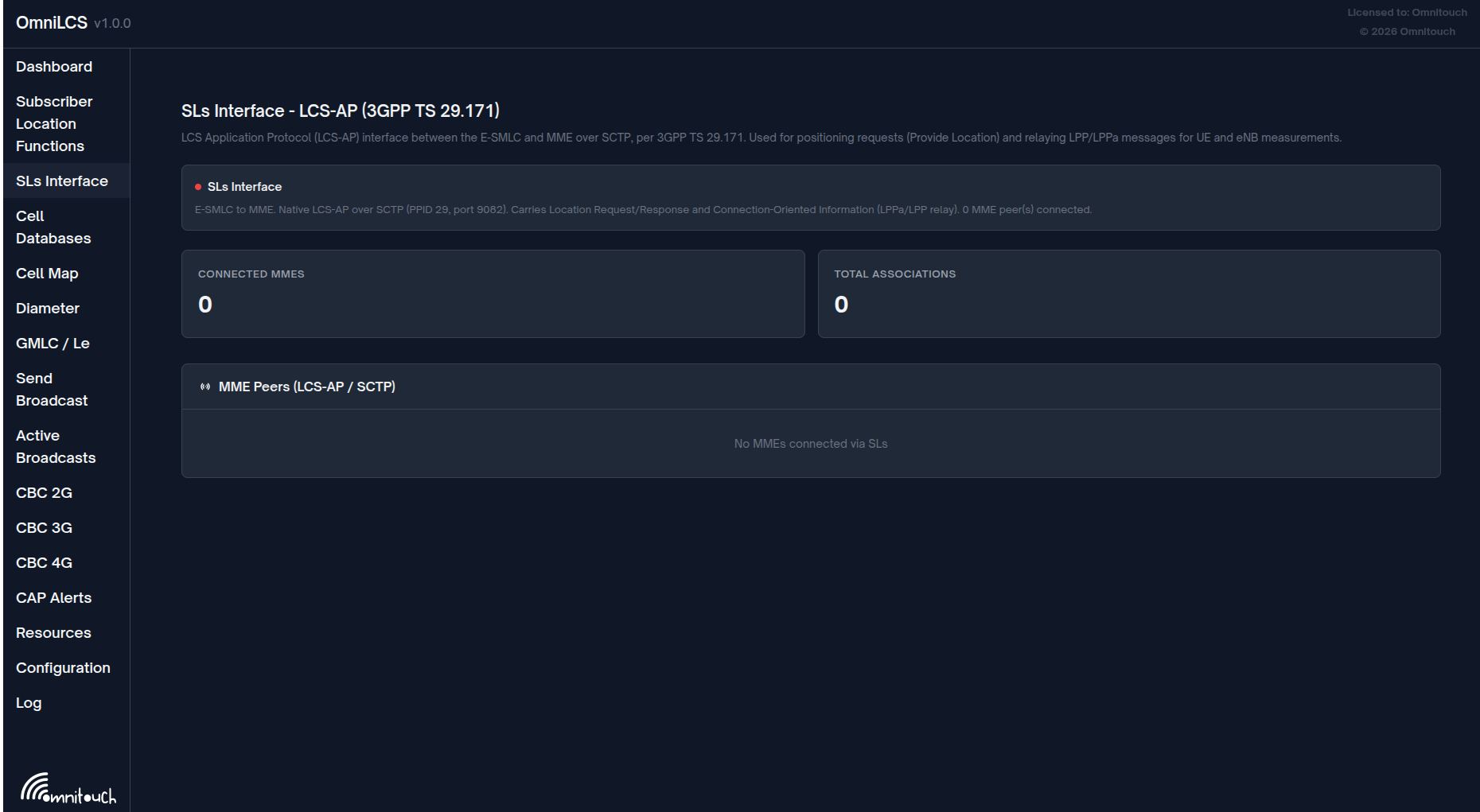
The E-SMLC communicates with the MME using the LCS Application Protocol (LCS-AP) over SCTP per 3GPP TS 29.171. OmniLCS initiates SCTP associations to each configured MME peer.
Transport Details
| Parameter | Value |
|---|---|
| Protocol | LCS-AP over SCTP |
| SCTP PPID | 29 |
| Default port | 9082 (IANA registered) |
| Connection direction | E-SMLC initiates to MME |
| Encoding | ASN.1 PER aligned |
LCS-AP Procedures
| Procedure | Code | Description |
|---|---|---|
| Location Request / Location Response | 0 | E-SMLC requests MME to locate a UE |
| Connection Oriented Information | 1 | Relay LPPA/LPP PDUs (UE-associated, uses correlation_id) |
| Connectionless Information | 2 | Relay non-UE-associated LPPA PDUs |
| Location Abort | 3 | Abort an in-progress location procedure |
| Reset | 4 | Reset all location procedures |
Correlation ID
Every UE-associated LCS-AP transaction uses a correlation ID -- a 4-byte binary value that ties together the Location Request, all Connection Oriented Information exchanges, and the Location Response for a single positioning session. The E-SMLC generates a random correlation ID at the start of each session using :crypto.strong_rand_bytes(4).
The correlation ID is included as an IE (ID 2) in:
- Location Request (E-SMLC -> MME)
- Location Response (MME -> E-SMLC)
- Connection Oriented Information (both directions)
- Location Abort (E-SMLC -> MME)
APDU Tunneling
LPP and LPPA PDUs are carried inside LCS-AP Connection Oriented Information messages. The payload type IE (ID 15) identifies the content:
| Payload Type | Value | Description |
|---|---|---|
:lPP | 0 | LPP PDU (UE positioning protocol, TS 36.355) |
:lPPa | 1 | LPPa PDU (eNB positioning protocol, TS 36.455) |
The APDU IE (ID 1) carries the binary LPP or LPPa PDU. The MME transparently relays these between the E-SMLC and the target eNB or UE.
Inbound Messages (MME -> E-SMLC)
Location Response (procedure code 0, successfulOutcome / unsuccessfulOutcome)
The MME sends a Location Response as the outcome of a Location Request.
| IE | ID | Criticality | Description |
|---|---|---|---|
| Correlation-ID | 2 | Reject | Correlation ID from the original Location Request |
| Location-Estimate | 12 | Reject | GAD-encoded position (on success) |
| Positioning-Data | 16 | Reject | Positioning method information (on success) |
| Velocity-Estimate | 21 | Reject | Velocity of the UE (optional, on success) |
| Accuracy-Fulfilment-Indicator | 0 | Reject | Whether requested accuracy was met (on success) |
| LCS-Cause | 11 | Ignore | Failure cause (on failure) |
Connection Oriented Information (procedure code 1, initiatingMessage)
The MME relays LPPA/LPP PDUs from the eNB or UE back to the E-SMLC.
| IE | ID | Criticality | Description |
|---|---|---|---|
| Correlation-ID | 2 | Reject | Session correlation |
| Payload-Type | 15 | Reject | :lPP or :lPPa |
| APDU | 1 | Reject | Binary LPP or LPPa PDU |
Reset Request (procedure code 4, initiatingMessage)
The MME requests the E-SMLC to reset all active procedures. The E-SMLC responds with a Reset Acknowledge.
| IE | ID | Criticality | Description |
|---|---|---|---|
| LCS-Cause | 11 | Ignore | Reason for reset |
Outbound Messages (E-SMLC -> MME)
Location Request (procedure code 0, initiatingMessage)
The E-SMLC requests the MME to locate a UE.
| IE | ID | Criticality | Description |
|---|---|---|---|
| Correlation-ID | 2 | Reject | 4-byte session correlation ID |
| Location-Type | 13 | Reject | geographic-Information, assistance-Information, or last-known-location |
| E-UTRAN-Cell-Id | 4 | Ignore | E-CGI of the UE serving cell |
| LCS-Client-Type | 8 | Reject | Type of LCS client (optional) |
| LCS-Priority | 9 | Reject | Location request priority (optional) |
| LCS-QoS | 10 | Reject | Quality of service requirements (optional) |
| IMSI | 7 | Ignore | UE IMSI (optional) |
| IMEI | 6 | Ignore | UE IMEI (optional) |
| Include-Velocity | 5 | Reject | Request velocity estimate (optional) |
Connection Oriented Information (procedure code 1, initiatingMessage)
The E-SMLC sends LPPA/LPP PDUs to the eNB or UE via the MME.
| IE | ID | Criticality | Description |
|---|---|---|---|
| Correlation-ID | 2 | Reject | Session correlation |
| Payload-Type | 15 | Reject | :lPP or :lPPa |
| APDU | 1 | Reject | Binary LPP or LPPa PDU |
Connectionless Information (procedure code 2, initiatingMessage)
The E-SMLC sends non-UE-associated LPPA PDUs (e.g., eNB position requests) through the MME.
| IE | ID | Criticality | Description |
|---|---|---|---|
| Source-Identity | 19 | Reject | E-SMLC network element identity |
| Destination-Id | 3 | Reject | Target eNB network element identity |
| APDU | 1 | Reject | Binary LPPa PDU |
Location Session Lifecycle
Each session tracks:
| Field | Description |
|---|---|
session_id | Unique identifier (e.g., esmlc-1234567890-1) |
imsi | UE identifier |
mme_host | MME that originated the request |
method | Positioning method used |
state | Current session state |
created_at | Session creation timestamp |
updated_at | Last state change timestamp |
completed_at | Completion timestamp |
lppa_transactions | List of LPPA PDUs exchanged |
lpp_transactions | List of LPP PDUs exchanged |
measurements | Accumulated measurement data |
result | Final location result |
Sessions older than 1 hour can be cleaned up via LocationSession.cleanup_old_sessions/1.
Pending Transaction Correlation
The E-SMLC uses an ETS table (:pending_transactions) to correlate outgoing LCS-AP messages with their responses. When a positioning session sends a Connection Oriented Information message:
- The engine generates a 4-byte correlation ID
- Registers
{correlation_id, {caller_pid, ref}}in the:pending_transactionstable - Sends the LCS-AP message via the SCTP transport
- Waits in a
receiveblock for the response - When the SLs handler receives a matching response, it looks up the pending transaction by correlation ID and sends the result to the waiting process
Cell Database Management
The cell database stores geographic positions and radio parameters for each cell site. It is used for Cell ID positioning and OTDOA calculations.
Cell Record Fields
| Field | Type | Required | Description |
|---|---|---|---|
cell_id | any | Yes | Unique cell identifier |
latitude | float | Yes | Cell latitude in decimal degrees |
longitude | float | Yes | Cell longitude in decimal degrees |
pci | integer | No | Physical Cell Identity (0-503) |
earfcn | integer | No | E-UTRA Absolute Radio Frequency Channel Number |
radius | integer | No | Cell coverage radius in meters (default: 1000) |
azimuth | float | No | Antenna azimuth in degrees |
height | float | No | Antenna height in meters |
prs_config | map | No | PRS configuration for OTDOA |
PRS Configuration Fields
| Field | Type | Description |
|---|---|---|
bandwidth | integer | PRS bandwidth in resource blocks (6, 15, 25, 50, 75, 100) |
config_index | integer | PRS configuration index (0-4095) |
num_dl_frames | integer | Number of consecutive DL subframes |
cp_length | atom | Cyclic prefix length (:normal or :extended) |
num_antenna_ports | integer | Number of antenna ports (1, 2, or 4) |
InfluxDB Cell Sync
Cell positions are periodically synchronized from InfluxDB:
| Parameter | Value | Description |
|---|---|---|
| Sync interval | 5 minutes | Automatic sync period |
| Initial delay | 10 seconds | Delay before first sync after startup |
| Sync timeout | 60 seconds | Maximum time for a sync operation |
Sync can also be triggered manually via:
- REST API:
POST /api/cells/sync - LiveView UI: "Sync from InfluxDB" button on the Cells page
JSON Import
Cells can be imported from a JSON file:
[
  {
    "cell_id": "001-01-0001-01",
    "latitude": 40.7128,
    "longitude": -74.0060,
    "pci": 100,
    "earfcn": 1300,
    "radius": 500,
    "prs_config": {
      "bandwidth": 50,
      "config_index": 0,
      "num_dl_frames": 1
    }
  }
]
Nearby Cell Search
The cell database supports geographic proximity queries using the Haversine formula for great-circle distance calculation. Query via REST API: GET /api/cells/nearby?lat=X&lon=Y&radius=R where radius is in kilometers.
OTDOA Calculation
The OTDOA calculator converts RSTD (Reference Signal Time Difference) measurements into a UE position using multilateration.
Algorithm
- RSTD to distance difference:
dd = RSTD * Ts * cwhere Ts = 1/(15000 * 2048) seconds and c = speed of light - Coordinate projection: Cell lat/lon coordinates are projected to a local meter-based coordinate system
- Iterative least squares: Solves the hyperbolic positioning equations using weighted least squares with Jacobian-based optimization
- Convergence: Iterates until position change is less than 1 meter or maximum 50 iterations
- Uncertainty estimation: Computed from measurement geometry and distance differences
Requirements
- Minimum 2 neighbour cells (plus reference cell = 3 total) for a position estimate
- 3 or more neighbours recommended for unambiguous 2D fix
- All cells must have known positions in the cell database
- Cell positions are resolved by PCI, ECGI, or cell_id
REST API Reference for Location
See REST API Reference for the full endpoint documentation. Key location endpoints:
| Endpoint | Method | Description |
|---|---|---|
/api/location | POST | Request a new UE location |
/api/location | GET | List recent location fixes |
/api/location/:imsi | GET | Last known location for an IMSI |
/api/location/:imsi/history | GET | Location history for an IMSI |
/api/location/:imsi/history/csv | GET | CSV export of location history |
Troubleshooting
No SLs Peers Connected
- Verify the
:slsconfiguration:local_ipmust be reachable from the MME network - Check that each
mme_peersentry has the correct IP address and port (default 9082) - Look for SCTP connection errors in the log:
SLs: Failed to connect to MME - Verify SCTP is not blocked by firewalls (IP protocol 132)
- Confirm the MME is listening for LCS-AP on port 9082
Location Request Returns "no_mme_host"
The E-SMLC cannot determine which MME to send LPPA/LPP messages to. Ensure:
- At least one SLs SCTP association is established
- For REST API requests, provide the
mme_hostparameter - Check the SLs connection status on the Dashboard page
No LCS-AP Response from MME
- Verify the SCTP association is in
:establishedstate viaSctpTransport.get_connections/0 - Check for SCTP heartbeat failures in the log
- Confirm the MME supports LCS-AP (TS 29.171)
- Check that the correlation ID is being correctly matched between request and response
Cell ID Positioning Returns No Coordinates
The cell database does not contain a matching cell. Actions:
- Trigger an InfluxDB sync:
POST /api/cells/sync - Add cells manually via the REST API or LiveView UI
- Import cells from a JSON file
OTDOA Timeout
The eNB did not respond with OTDOA information within the timeout period. Possible causes:
- eNB does not support LPPA OTDOA Information procedure
- PRS is not configured on the eNB
- Network path issue between MME and eNB
GNSS Timeout
The UE did not report GNSS coordinates within the timeout. Possible causes:
- UE does not support GNSS positioning
- UE is indoors (no satellite visibility)
- No GNSS assistance data provided (cold start takes longer)
3GPP References
| Specification | Title |
|---|---|
| TS 29.171 | LCS Application Protocol (LCS-AP) between MME and E-SMLC (SLs interface) |
| TS 29.172 | EPC LCS Protocol between GMLC and MME (SLg Diameter interface) |
| TS 36.455 | LTE Positioning Protocol A (LPPa) between eNB and E-SMLC |
| TS 36.355 | LTE Positioning Protocol (LPP) between UE and E-SMLC |
| TS 23.032 | Universal Geographical Area Description (GAD encoding) |